660 Channels Smart Hi-Target GPS Surveying Instrument V200 Gnss Rtk with Ihand55 Controller

|
Basic Info. Model NO. V200 Channel 660 Tilt Survey Support External Radio 30W Transport Package Carton Specification 30kg Trademark hi-target Origin China HS Code 8526919090 Production Capacity 4000/Year SPECIFICATIONS V200 specification Channels 800+ ......
Jiangsu Yunxi Space Information Technology Co., Ltd
|
1598 channels SOUTH G9 Topographic Instrument RTK Surveying Equipment High Accuracy Gps Receiver

|
1598 channels SOUTH G9 Topographic Instrument RTK Surveying Equipment High Accuracy Gps Receiver Overview Products Description Signal tracking channels 1598 channels BDS-2 B1I,B2I,B3I BDS-3 B1I,B3I,B1C,B2a,B2b GPS L1C/A,L2P,L2C,L5,L1C* GLONASS G1,G2,G3* ......
Chengdu Jiebo Technology Co., Ltd.
|
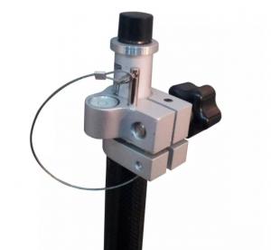
Hi-Target Carbon Fiber Poles used for Hi-Target GPS for surveying instrument

|
Detail Specification : Hi-Target Carbon Fiber Poles used for Hi-Target GPS for surveying instrument specification 2m*4 second max length 2m min lenth1m diameter 0.33cm packaging:1pc/soft carry bag 10pcs/carton connect can choose We can use the different ......
Shanghai Hengyide Electronic Technology Co.,Ltd Ltd.
|
Dual Frequency Superior Instrument Hi-target GPS

|
Dual Frequency Superior Instrument Hi-target GPS It is designed to meet high quality standards at an affordable price. It is outstanding in its class, with a rugged design and user-friendly functions. V30 GPS is equipped with a smart speaker guiding the ......
Chongqing Gold Mechanical & Electrical Equipment Co.,Ltd
|
Hi target Underwater Topographic surveying instrument HD-Max Echo depth sounders

|
Jimmy Yin Chongqing Gold Mechnical & Electrical Equipment Co.,Ltd Email: gold02@hy-industry.com Mobile: +86-15998954947 HD-MAX is a full-digit echo sounder for precision measurement in hydrology, reconnaissance, fairway, wharf dredge and so on. Featuring......
Chongqing Gold Mechanical & Electrical Instrument Co., Ltd.
|
The KLSA-PN Laser Ranging Sensor For Topographic Mapping

|
...ranging sensor for topographic mapping Introduction Laser distance sensor is a precision instrument that uses laser technology to achieve non-contact distance measurement. It determines the distance, position or displacement of the target object by ......
Xi'an Kacise Optronics Co.,Ltd.
|
HI-Target RTK GPS Huaxing A10 GPS Receiver for Survey

|
Hi-Target A10 Gnss Rtk System Made in China Hi-target huaxing A10 GNSS RTK SYSTEM Performance advantage By adopting the new design, higher quality, better performance and lighter weight, and changing the past imitation characteristics, the shell adopts......
Shanghai Magcach Technology Co.Ltd
|
LASERSHOT Brand new 4th generation binoculars digital night vision device DB1920 for day and night use all-weather

|
... vision forensics instrument, not only variable magnification observation, zooming in or pushing away the viewing target, but also supporting ultra-high-definition photography and video recording; outdoor GPS positioning function can effectively locate the ......
Shenzhen Xinxing Southern Industrial Development Co., Ltd.
|
