Lightweight ARS-1000L UAV LiDAR Terrain Mapping System 5m-1350m Range

|
4.5kg lightweight 15mm@150m ARS-1000L UAV LiDAR System multi operation mode and 5m to 1350m range ARS-1000L UAV LiDAR system is a is a Riegl LiDAR based system which developed and built by Hi-Cloud. It integrates sensors such as high-precision laser, high-......
Wuhan Hi-Cloud Technology Co.,Ltd
|
Terrain Mapping Aerial Surveying Geosun UAV LiDAR System GS-130X High Precision

|
...tem GS-130X integrates Hesai XT32 laser sensor and all built-in units to create a futuristic look for your diversified LiDAR solution services.Stands out with strong penetration and small beam divergence in same uav lidar scanning system class to deliver a...
Wuhan Geosun Navigation Technology Co., Ltd.
|
Lidar Cloud Map Matching And Environment Sensing Devices For Driverless Car Navigation

|
..., the liDAR point cloud map matching and environment sensing equipment can realize the functions of high-precision map matching and positioning, online precision mapping, typical target identification and tracking and relative distance measurement, etc....
Xi'an Kacise Optronics Co.,Ltd.
|
DJI Zenmuse L2 lidar M350 RTK with integrated lidar and mapping camera for emergency response/topographic mapping

|
...
Jiangsu Yunxi Space Information Technology Co., Ltd
|
Electrical Powered Aerial Survey Drone , Lightweight Fixed Wing Mapping Drone

|
Electric Powered 2 Hours Fixed Wing Drone Aerial Surveillance Surveying Mapping UAV Product features: Light, high strength, excellent fatigue strength, strong pulling, Low noise Precise dynamic-static balance, good to reduce the abrasion for engine and ......
Airbus Carbon Composite Technology Co. ,Ltd
|
W50 LiDAR System Compact Powerful Mapping Tool Compatible To DJI M300 M350

|
... features a long scanning range, lightweight, strong penetration and higher working efficiency than ever, which can deal with the most challenging and complex scenarios. Compact and powerful, the W50 integrates LiDAR, IMU, and a 26 MP camera, optimized for...
Wuhan Eleph-Print Tech Co.,Ltd
|
ISO 9223 C4 Anti Corrosion Wind Measurement Lidar Molas 3D Wind Lidar System

|
...Lidar 1,Product introduction The wind shear detection application of 3D wind LiDAR system is applied to Hong Kong International Airport for the first time. The terrain conditions of Hong Kong International Airport are complex. 70% of the wind shear is caused by the terrain. On average, one flight out of 500 flights reported encountering obvious wind shear. After the application of lidar......
Nanjing Movelaser Co., Ltd.
|
50m Digital Lidar Distance Sensor , USB Long Range Lidar Sensor 3hz

|
...Lidar Distance Sensor 3hz Description: 50m Digital Lidar Distance Sensor with USB,we also call it secondary development laser distance sensor, which support TTL level and CMOS. JRT Lidar Distance Sensor with USB can be widely used in professional surveying, mapping......
Chengdu JRT Meter Technology Co., Ltd.
|
300ML Intelligent Robot Vacuum With Smart Mapping Cleaner 2.8kg

|
CR05 robot vacuum with smart mapping LIDAR navigation smart WIFI robot cleaner intelligent vacuum cleaner Features: Always ready to clean: Up to 60-90 minutes of runtime (quiet suction on hard floors). Power adapter: Input 100-240V~50/60Hz1.0A, Output DC ......
Shenzhen E-Ran Technology Co. Ltd
|
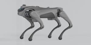
Intelligent Robot Dog With 2D LiDAR L1 Automatic Telescopic Handle Strap For Autonomous Navigation And Mapping

|
Product Background Bionics provides theoretical and inspirational sources for the development of quadruped robots. Scientists have conducted in-depth research on the movement patterns, body structure, and musculoskeletal system of quadruped animals, ......
Shenzhen Baohong intelligent manufacturing Co., LTD
|
